


Level 32 Times High Precision Level, Automatic Level, Engineering Surveying Level, Outdoor Surveying and Mapping Instrument
- Pre-Order Available (Estimated ±15 Day Delivery)
- 7 day unit replacement guarantee(Video Unboxing Required)
- Including shipping costs, sent by Supplyinx.com
- Pick up at a supplyinx.com collection point is possible
- 24/7Customer service
Description
32 Times High Precision Level, Automatic Level, Engineering Surveying Level, Outdoor Surveying and Mapping Instrument
High-Precision Automatic Level for Surveying and Mapping – Reliable and Accurate Measurement for Construction and Engineering Projects
Product Description
The 32 Times High Precision Level is a state-of-the-art surveying instrument designed to provide accurate leveling for engineering surveys, construction projects, and geospatial mapping. This automatic leveling instrument offers 32x magnification and high-precision leveling for use in a variety of outdoor surveying tasks. It is ideal for site layout, building alignment, foundation leveling, and other construction and surveying applications.
Equipped with an automatic leveling system, this level offers quick setup and ensures consistent accuracy even in uneven terrain. Whether you’re working on land surveying, building construction, or topographic mapping, this instrument provides reliable and precise measurements for all your engineering and surveying needs.
Key Features
-
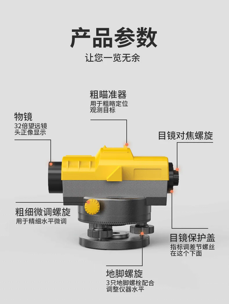
✅ 32x Magnification: Provides sharp, clear views and precise measurements, making it suitable for long-distance and high-accuracy leveling tasks.
-
✅ Automatic Leveling: Features an automatic leveling system, ensuring that the instrument remains accurate and stable without the need for manual adjustments.
-
✅ High Precision: Offers high-precision leveling, with 0.02mm of leveling accuracy, ensuring reliable results for surveying and construction applications.
-
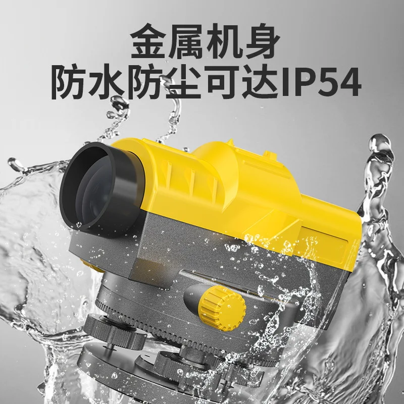
✅ Durable and Weather-Resistant: Designed for use in harsh outdoor environments, with waterproof, dustproof, and shock-resistant features to withstand the rigors of field operations.
-
✅ Easy to Use: User-friendly design with simple controls and clear readings, making it accessible to both beginners and professional surveyors.
-
✅ Long Battery Life: Equipped with a long-lasting rechargeable battery, the instrument is ideal for extended fieldwork without the need for frequent recharging.
-
✅ Lightweight and Portable: Compact and lightweight design, making it easy to transport and set up on-site for various surveying and mapping projects.
Technical Specifications
-
Model: 32 Times High Precision Automatic Level
-
Magnification: 32x for sharp and clear views
-
Leveling Accuracy: 0.02mm/km (for long-distance measurements)
-
Automatic Leveling: Automatic leveling system for accurate horizontal alignment
-
Display: Clear and easy-to-read dial or digital interface
-
Battery: Rechargeable high-capacity battery for long operation
-
Protection Rating: IP54 (dustproof and water-resistant)
-
Weight: Approx. 1.5 – 2 kg (depending on model)
-
Power Supply: 12V DC rechargeable battery
-
Operating Temperature: -20°C to 50°C, suitable for outdoor field conditions
-
Tripod Compatibility: Standard tripod mount for stable operation in different environments
Applications
-
Land Surveying: Ideal for boundary surveys, topographic surveys, and land development projects requiring accurate leveling and alignment.
-
Construction Projects: Used for foundation leveling, site layout, and structural alignment in building construction, road building, and other engineering projects.
-
Geospatial Mapping: Perfect for mapping terrains, surveying natural features, and creating accurate land data for urban planning and land management.
-
Engineering Surveying: Suitable for construction alignment, geotechnical surveys, and environmental studies where accurate leveling and alignment are critical.
-
Infrastructure Projects: Used for measuring alignment, leveling of roads, bridges, and other civil engineering projects.
Summary
The 32 Times High Precision Automatic Level is a high-accuracy leveling instrument designed for surveying, construction, and geospatial mapping. With 32x magnification, automatic leveling, and high-precision measurements, this instrument is ideal for land surveys, construction alignment, and site layout tasks. Its rugged design, long battery life, and user-friendly operation make it a reliable tool for fieldwork in harsh environments.


Related products


Foif RTS102R10 2″ Accuracy Total Station Measuring Surveying Instrument, 1000m Prism-free


Double Laser Electronic Theodolite High Precision Building Engineering Decoration Measuring Tools Precision Mapping Instrument


Reviews
There are no reviews yet.