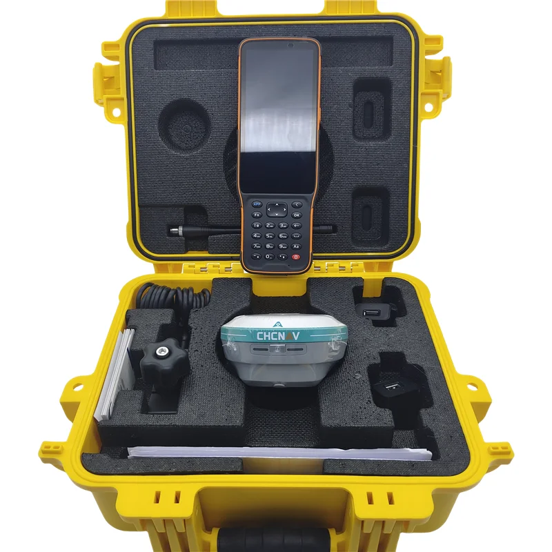
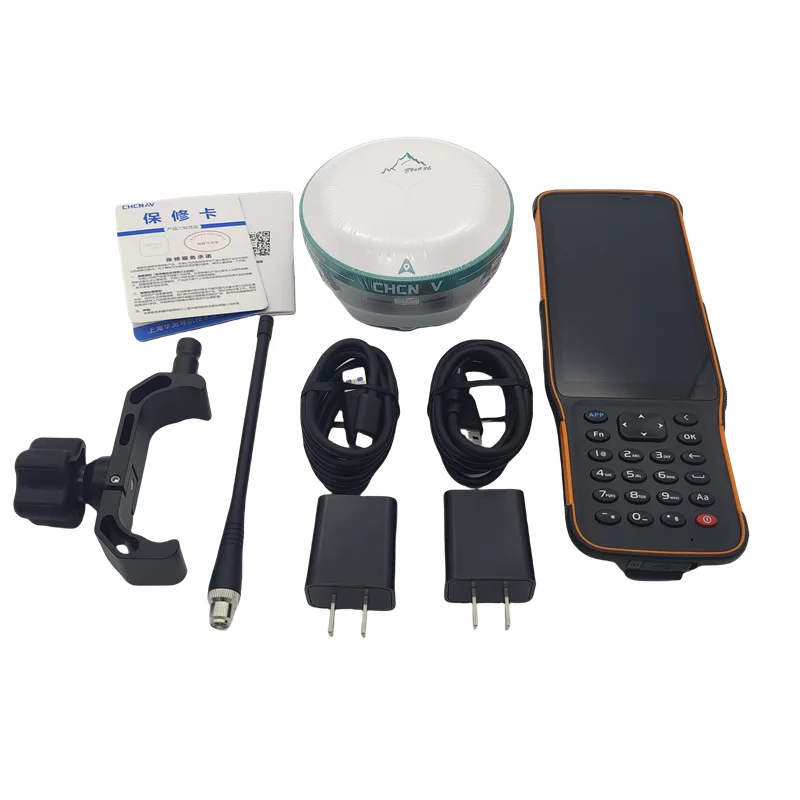
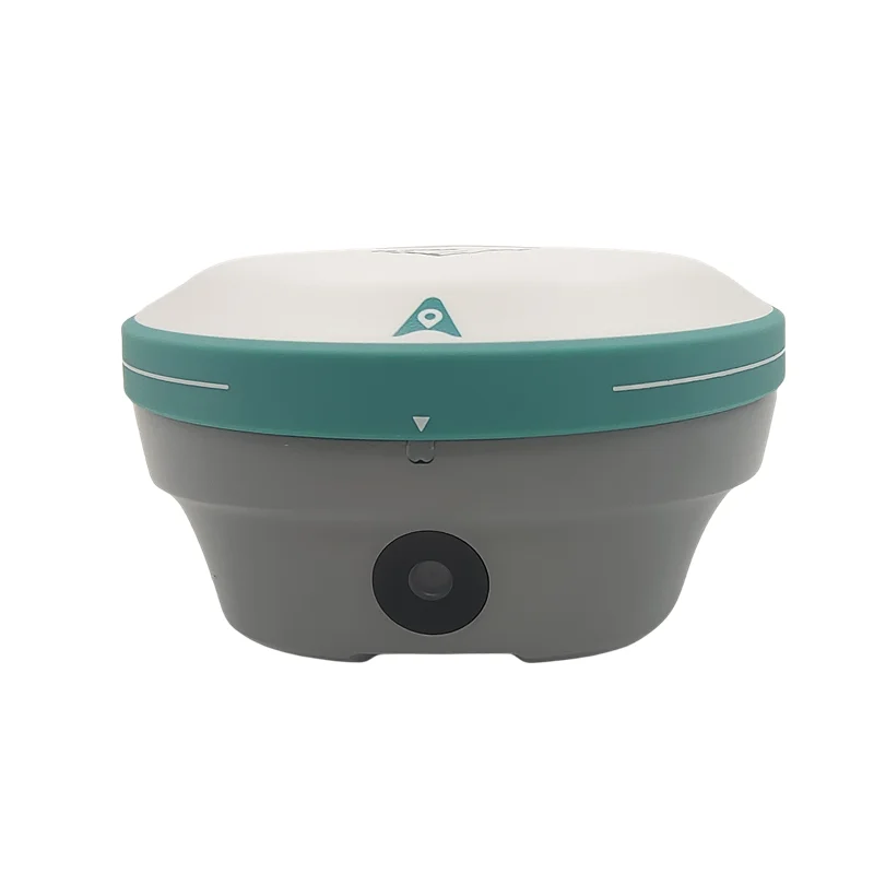
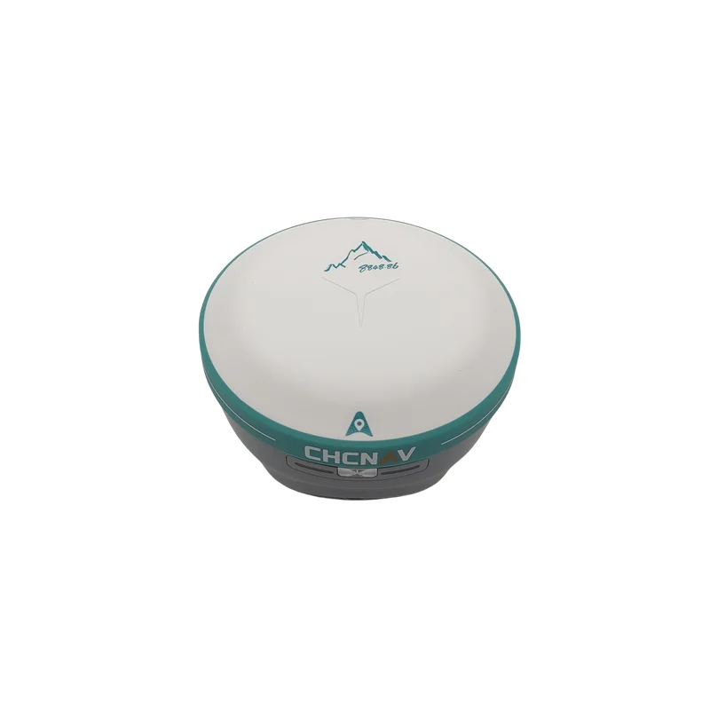
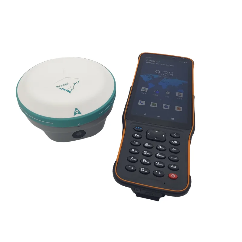
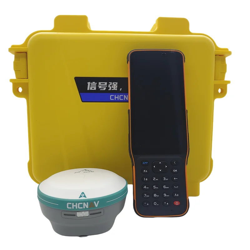
Hot Sale CHC T10P GPS RTK GNSS Receiver Surveying Equipment
- Pre-Order Available (Estimated ±15 Day Delivery)
- 7 day unit replacement guarantee(Video Unboxing Required)
- Including shipping costs, sent by Supplyinx.com
- Pick up at a supplyinx.com collection point is possible
- 24/7Customer service
Description
CHC T10P adalah GNSS RTK receiver dengan performa tinggi yang dirancang untuk pekerjaan survei profesional. Mendukung multi-konstelasi satelit dan dilengkapi teknologi presisi tinggi, T10P memberikan hasil cepat, stabil, dan akurat di berbagai kondisi lapangan. Dengan desain ringkas, tangguh, serta harga kompetitif (hot sale), alat ini menjadi pilihan tepat untuk surveyor dan kontraktor.
Spesifikasi Utama
-
Channels: Mendukung GPS, GLONASS, BeiDou, Galileo, QZSS, SBAS
-
Akurasi RTK: H: ±8 mm + 1 ppm, V: ±15 mm + 1 ppm
-
Inisialisasi RTK: <10 detik, reliabilitas >99%
-
Fitur:
-
IMU tilt compensation (hingga ±60°)
-
E-bubble & auto-initialization
-
Network RTK (NTRIP), CORS compatible
-
-
Komunikasi: 4G LTE modem, Wi-Fi, Bluetooth, UHF radio internal
-
Daya: Baterai Li-ion isi ulang, operasi ±10–12 jam
-
Desain: Ringkas, ringan, portabel
-
Ketahanan: IP67 tahan air & debu, tahan jatuh ±2 m
Pengaplikasian
-
Survei geodesi & topografi presisi tinggi
-
Pemetaan lahan & batas properti
-
Setting-out proyek sipil & infrastruktur
-
Monitoring dan pemetaan berbasis CORS / RTK Network
|
TECHNICAL PARAMETER
|
|
|
||
|
project
|
content
|
index
|
||
|
Satellite tracking
|
Satellite system
|
GPS+BDS+Glonass+Galileo+QZSS+TRNSS+SBAS,Support the third generation of Beidou
|
||
|
|
|
Support Beidou three generations,support Five star 21
frequency point |
||
|
|
Satellite tracking
|
BDS:B1I,B2I,B3I,B1C,B2a,B2b*
|
||
|
|
|
GPS:L1C/A, L2C, L2P, L5
|
||
|
|
|
GLONASS:G1,G2,G3*
|
||
|
|
|
Galileo:E1,E5a,E5b,E6*
|
||
|
|
|
QZSS:L1C/A,L1C,L2C,L5
|
||
|
|
|
IRNSS:L5*
|
||
|
|
|
SBAS:L1
|
||
|
|
Channel
|
1408
|
||
|
|
Initialization
reliability |
99.99%
|
||
|
|
No network
continued test |
support
|
||
|
|
Anti interference
|
Narrowband anti-interference technology effectively shields the internal electromagnetic interference of the
host |
||
|
Accuracy
|
Static accuracy
|
Planar accuracy:±(2.5mm+0.5×10⁻⁶×D)mm
|
||
|
|
|
Elevation accuracy:±(5mm+0.5×10⁻⁶×D)mm
|
||
|
|
RTK accuracy |
Planar accuracy:±(8mm+1×10⁻⁶×D)mm
|
||
|
|
|
Elevation accuracy:±(15mm+1×10⁻⁶×D)mm
|
||
|
|
Tilt compensation
accuracy |
8mm+0.3mm/°tilt (accuracy <2cm within 30°)
|
||
|
|
Video
measurement accuracy |
Planar accuracy:±(8mm+1×10⁻⁶×D)mm Elevation accuracy:±(15mm+1×10⁻⁶×D)mm
|
||
|
GNSS+Inertial
navigation |
IMU update rate
|
200Hz
|
||
|
|
Tilt Angle
|
0-60°
|
||
|
|
Insensitive super
inertial navigation |
Fifth generation Ultra IMU technology, automatic inertial navigation initialization, reliable accuracy
|
||
|
User interaction
|
Pilot lamp
|
Linkage dual LED signal light (differential data light+power light)
|
||
|
|
key
|
Single button
|
||
|
|
web page
|
Support PC/mobile web page
|
||
|
camera
|
Characteristic
function |
Real time AR image viewing CAD AR full map real scene layout
|
||
|
|
pixel
|
2MP
|
||
|
|
Field of view
|
95 °+3 °, wide-angle dual camera
|
||
|
|
Aperture
|
F2.4 large aperture, clear even in low light
|
||
|
|
Frame rate
|
30fps, low latency for layout, stable image quality without jitter
|
||
|
Physical
characteristics |
dimension
|
φ106mm*55.6mm
|
||
|
physical
properties |
weight
|
450g (battery included)
|
||
|
|
material
|
Magnesium alloy
|
||
|
|
Operating
temperature |
-45℃~+75℃
|
||
|
|
Storage
temperature |
-55℃~+85℃
|
||
|
|
Waterproof and
dustproof |
IP68(30 minutes underwater 1 meter immersion)
|
||
|
|
anticollision
|
IK08 (subjected to the same mechanical impact as the 2.5kg
steel ram without damage,resistance to 3m drops) |
||
|
|
anti-condensation
|
100%
|
||

Small size
Strong battery life


F2.4 Large Aperture
No network continued test

Related products


New 7×50 Marine Nitrogen Filled Waterproof and Fogproof Floating Rangefinder Binoculars with Compass


High Precision with IMU Function SMA26 Gnss Rtk Base And Rover Set For Land Surveying Instruments Gps Rtk receiver


NexStar 8SE Astronomical Telescope, Theodolite Bracket, Steel Tripod, Limit Gesture 14, 203/2000 Single Arm


