


Harbin Geologic Compass DQL-8A theodolite Professional Surveying
- Pre-Order Available (Estimated ±15 Day Delivery)
- 7 day unit replacement guarantee(Video Unboxing Required)
- Including shipping costs, sent by Supplyinx.com
- Pick up at a supplyinx.com collection point is possible
- 24/7Customer service
Description
Harbin Geologic Compass DQL-8A Theodolite Professional Surveying
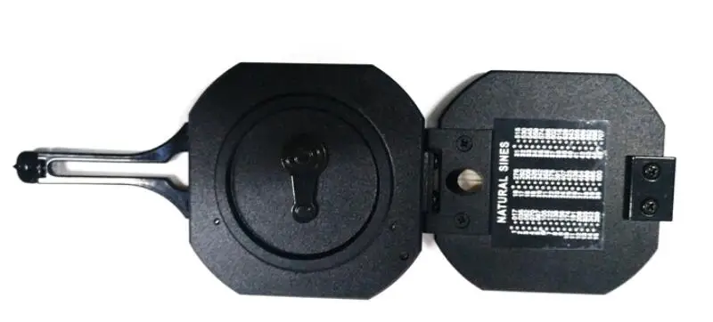
The Harbin Geologic Compass DQL-8A is a high-quality, professional surveying instrument specifically designed for geological surveys and geospatial measurements. This theodolite compass combines precision angular measurement with geological features, allowing for accurate mapping and orientation of geological structures such as fault lines, rock layers, and strata. The DQL-8A model is particularly useful for field surveys, offering reliable performance in harsh environments. Whether you are working in mining, engineering, or geological research, this compass provides stable, precise data for professional surveying.
Key Features
-
High Precision Angular Measurements
The DQL-8A Geologic Compass offers high-precision angular measurement with both horizontal and vertical angle readings. It is ideal for geological surveys where accurate azimuth, dip angles, and strike angles are essential for mapping and studying rock formations. -
Professional Theodolite Design
As a theodolite compass, the DQL-8A incorporates a graduated dial and sighting mechanism that provides precise angular alignment. This is particularly useful for geological mapping, structural analysis, and fault line investigations. -
Durable and Robust Construction
Built to withstand the demands of field use, the DQL-8A is made with rugged materials that can endure exposure to dust, moisture, and extreme temperatures. The instrument is designed for reliable operation in harsh outdoor conditions, ensuring that surveyors can trust its accuracy in challenging environments. -
Magnetic Compass
The magnetic compass feature allows the instrument to determine directional bearings and azimuths in geological studies. This is critical for determining the orientation of geological structures and for accurate mapping of landforms. -
Compact and Lightweight
Despite its professional-grade features, the Harbin Geologic Compass DQL-8A is designed to be lightweight and compact, making it easy to carry and use in remote locations or difficult terrain. Its portability ensures that it can be easily transported to various surveying sites. -
Geological Surveying Application
The compass is ideal for professionals conducting geological field studies, particularly those involved in mining, engineering, and environmental geology. It helps accurately measure geological features such as stratigraphy, tectonic movements, and fault planes.
Technical Specifications
-
Model: Harbin Geologic Compass DQL-8A
-
Angle Measurement:
-
Horizontal and vertical angular measurement for precise direction readings
-
Precision: ±0.5° for angular accuracy
-
-
Compass Function: Includes a magnetic compass for azimuth and strike measurements
-
Material: Made from durable metal with weather-resistant components
-
Sighting Mechanism: Adjustable sighting system for precise targeting and angle reading
-
Weight: Lightweight and portable design for easy transport
-
Field Use: Designed to withstand harsh environments, such as extreme temperatures and moisture exposure
-
Calibration: Pre-calibrated for quick, reliable use in geological surveys
Applications
-
Geological Mapping:
Ideal for geological surveys, the DQL-8A allows professionals to accurately measure angles and orientation of rock layers, fault lines, and other geological features, ensuring that mapping is accurate for research and planning purposes. -
Mining and Exploration:
In mining applications, the Harbin Geologic Compass helps professionals in the mining industry measure the orientation of rock strata and identify areas of interest for mineral extraction. It is crucial for exploring and evaluating mineral deposits. -
Engineering and Construction:
For civil engineers and construction projects, the compass provides angular measurements to assess the terrain, elevation changes, and rock stability, ensuring safe construction practices in regions with complex geological features. -
Environmental Research:
The DQL-8A is also used for environmental studies, where precise measurements of geological formations help in evaluating the impacts of natural processes or human activity on the land. -
Surveying:
As a professional surveying instrument, it provides accurate data for land surveys, particularly for mapping geological structures, topography, and natural features of the landscape.
Summary
The Harbin Geologic Compass DQL-8A is a high-precision surveying tool designed for geological fieldwork and professional surveying applications. Its durable construction, magnetic compass, and advanced theodolite features provide accurate and reliable angular measurements for professionals in fields such as mining, engineering, geology, and environmental research. With its compact and portable design, it is ideal for field use, ensuring precise geological mapping and angular alignment for all types of geospatial tasks. The DQL-8A is an essential tool for anyone needing reliable and accurate data for surveying, mapping, and geological studies.


