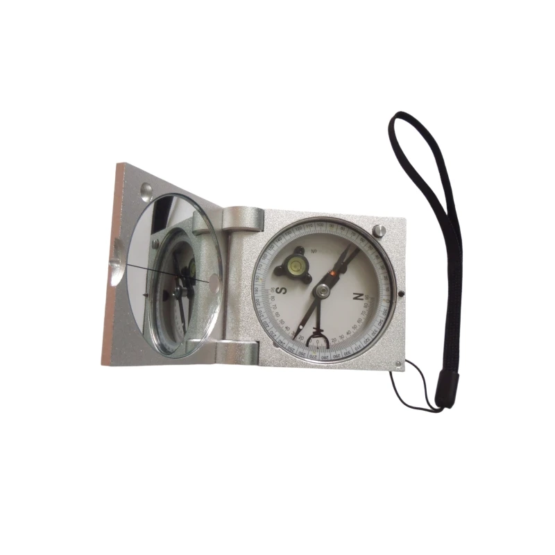


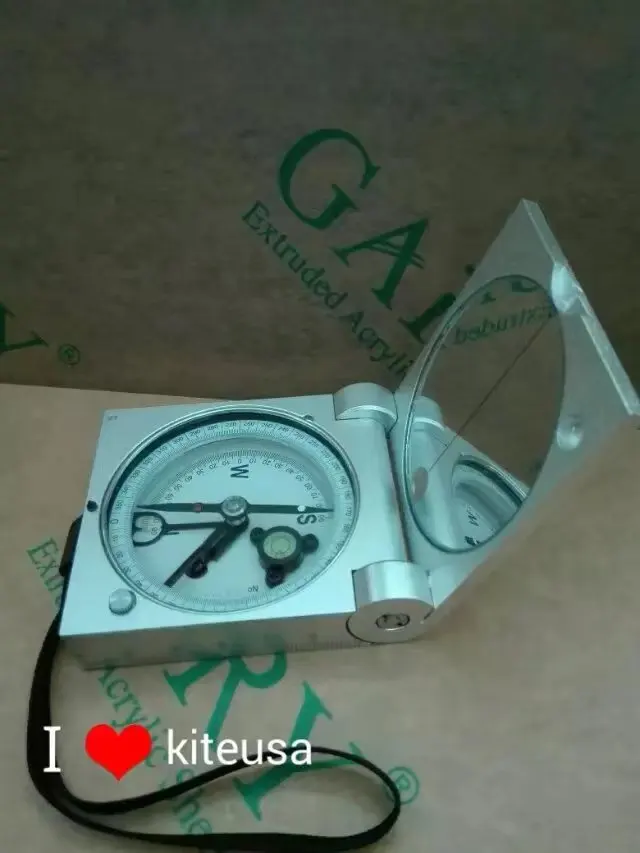
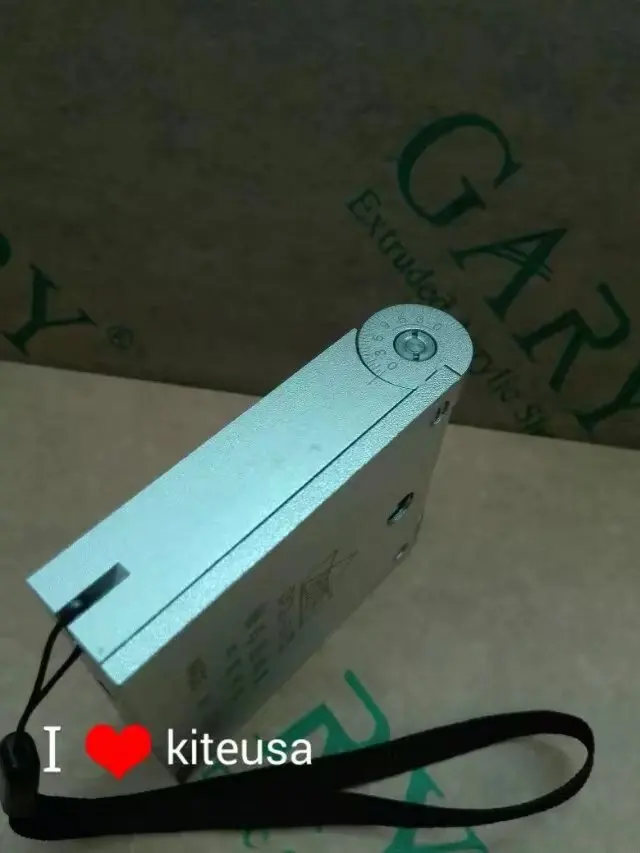
BRAND NEW DQL-2A Geologic Compass Portable geophysics Surveyors H-DQL-2A DQL-2A DQL2A Surveying instrument
- Pre-Order Available (Estimated ±15 Day Delivery)
- 7 day unit replacement guarantee(Video Unboxing Required)
- Including shipping costs, sent by Supplyinx.com
- Pick up at a supplyinx.com collection point is possible
- 24/7Customer service
Description
Brand New DQL-2A Geologic Compass Portable Geophysics Surveyors H-DQL-2A DQL-2A Surveying Instrument
DQL-2A Geologic Compass – Portable, High-Precision Geophysical Surveying Tool for Field Work and Geological Mapping
Product Description
The DQL-2A Geologic Compass is a high-precision surveying instrument designed for geological fieldwork and geophysical surveys. This portable geologic compass is engineered to provide accurate orientation and measurement of geological features such as strata, faults, and bedding planes. With simple, intuitive operation, it allows surveyors and geologists to conduct mapping, structural geology studies, and mining surveys with high efficiency in the field.
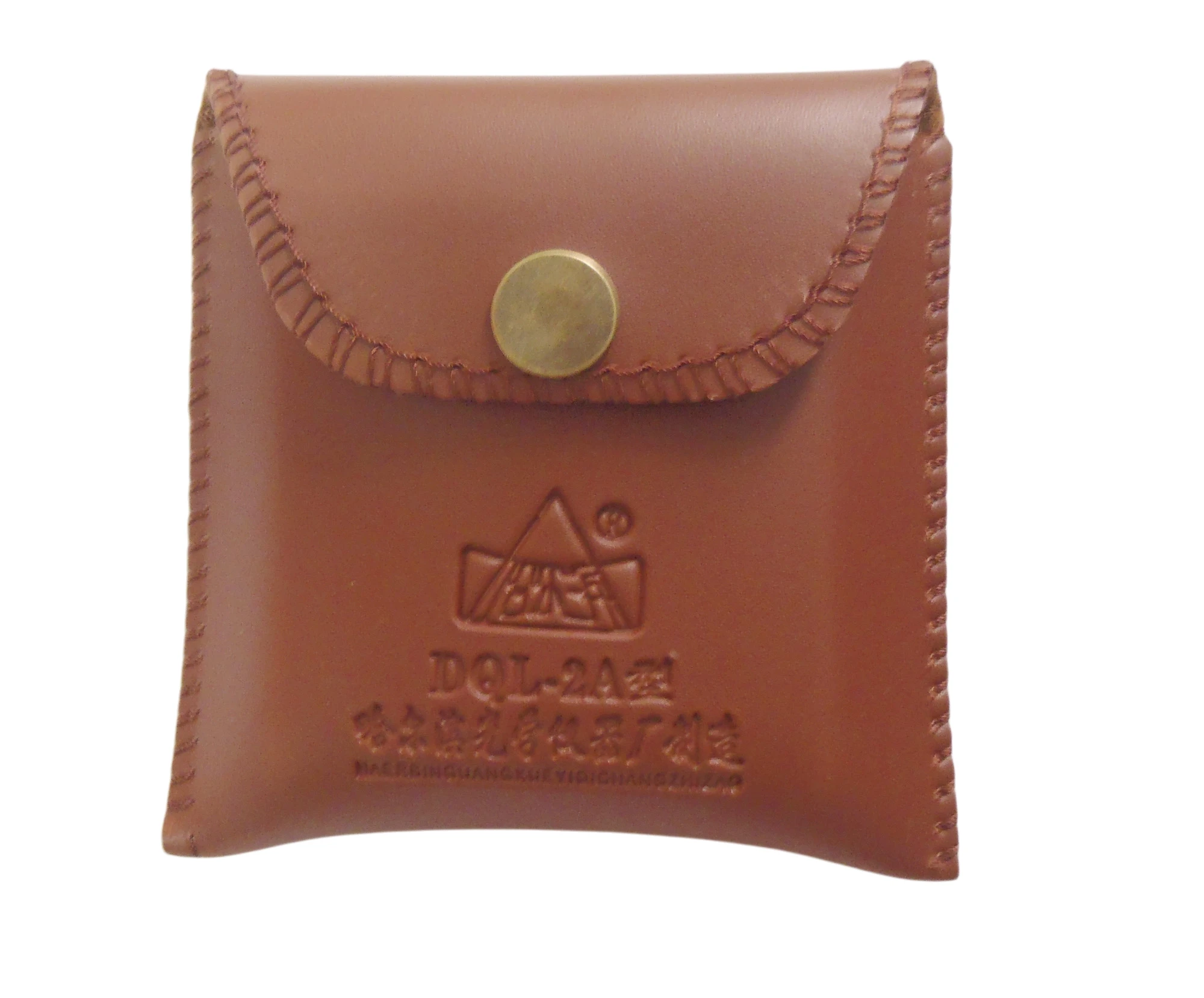
Built with durable materials, the DQL-2A is resistant to environmental factors and extreme weather conditions, making it ideal for use in outdoor environments. The compact design and lightweight construction ensure easy transport and setup for field operations, while the precision dial and clinometer provide accurate readings for geological and mining applications.
Key Features
-
✅ High-Precision Measurements: Provides accurate orientation and angle measurement for geological surveying, including strike, dip, and bedding planes.
-
✅ Portable Design: Compact and lightweight, making it easy to carry during field surveys in rugged terrain.
-
✅ Geological Compass: Specifically designed for geological applications, the compass offers precise readings for geological mapping and field surveying.
-
✅ Clinometer Integration: Built-in clinometer for measuring angle of slope and tilt of geological features, ideal for strata and fault plane mapping.
-
✅ Durable Construction: Made with high-quality materials to ensure resilience in harsh field conditions, including dust, moisture, and extreme temperatures.
-
✅ Easy to Use: Simple controls and clear dial for quick measurement and reliable data collection.
-
✅ Accurate Calibration: Features accurate calibration for precision in field geology tasks, ensuring reliable results.
-
✅ Versatile Applications: Perfect for geological mapping, surveying, mining exploration, and field-based structural geology studies.
Technical Specifications
-
Model: DQL-2A Geologic Compass
-
Measurement Range: 0° to 360° for azimuth or strike measurement
-
Dip Measurement: 0° to 90° for measuring dip or slope angles
-
Accuracy: ±1° for strike and dip measurements
-
Clinometer: Built-in clinometer for tilt angle measurement
-
Material: Durable, shock-resistant body with weatherproof design
-
Dimensions: Compact size for easy handling and transport
-
Weight: Approx. 200-300g, lightweight and portable
-
Power Source: Manual operation (no batteries required)
-
Operating Temperature: -20°C to 50°C, suitable for varied outdoor conditions
Applications
-
Geological Surveys: Ideal for geological field surveys, mapping geological formations, and conducting structural geology studies.
-
Mining and Exploration: Used for mineral exploration and geophysical surveying, including measuring mineral veins, strata mapping, and fault plane studies.
-
Engineering Projects: Essential for site layout and construction alignment in projects requiring geological data such as tunneling, foundation laying, and road building.
-
Environmental Monitoring: Used in environmental studies to measure geological features for land rehabilitation and earthquake preparedness.
-
Education and Research: Suitable for teaching purposes in geology departments and research projects that involve geophysical measurements.
Summary
The DQL-2A Geologic Compass is a high-precision portable tool designed for geological surveying and fieldwork. With its clinometer for angle measurement, accurate orientation for geological mapping, and rugged design, this instrument is perfect for surveyors, geologists, and mining professionals. Whether you’re performing site surveys, geophysical research, or mineral exploration, the DQL-2A ensures reliable and accurate data for your fieldwork and construction needs.
Related products


New 7×50 Marine Nitrogen Filled Waterproof and Fogproof Floating Rangefinder Binoculars with Compass


JUWEI17-100 Wide dovetail groove astronomical telescopes harmonic equatorial instrument compatible with theodolites


