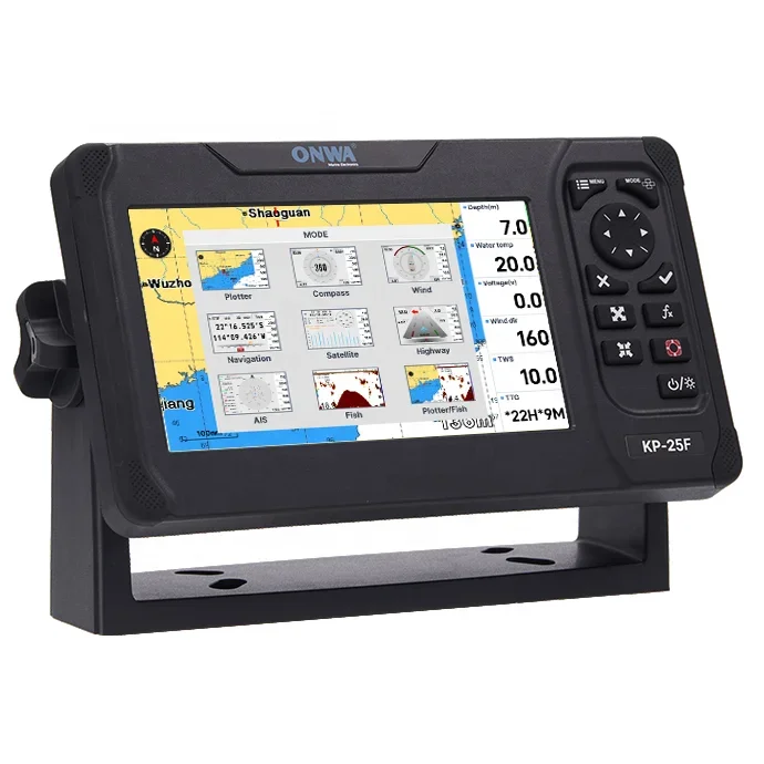
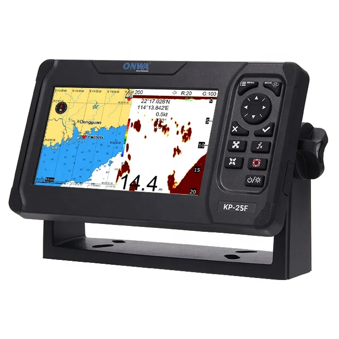


ONWA KP-25F 5 Inch GPS Chart Plotter Fish Finder/ GPS Navigator Echo Sounder /Depth Sounder
- Pre-Order Available (Estimated ±15 Day Delivery)
- 7 day unit replacement guarantee(Video Unboxing Required)
- Including shipping costs, sent by Supplyinx.com
- Pick up at a supplyinx.com collection point is possible
- 24/7Customer service
Description
ONWA KP-25F 5 Inch GPS Chart Plotter Fish Finder / GPS Navigator Echo Sounder / Depth Sounder
Deskripsi Produk
ONWA KP-25F adalah perangkat multifungsi yang menggabungkan GPS chart plotter, fish finder, dan echo sounder dalam satu unit dengan layar 5 inci. Alat ini dirancang untuk membantu para pemancing dan pelaut dalam navigasi, pencarian ikan, dan pengukuran kedalaman air secara akurat dan efisien.
Dengan GPS navigator terintegrasi, KP-25F menyediakan peta laut dan posisi kapal secara real-time, sementara echo sounder dan fish finder membantu mendeteksi keberadaan ikan serta memetakan kedalaman dasar perairan. Desain kompak dan mudah digunakan menjadikannya perangkat ideal untuk berbagai aktivitas di laut.
Fitur Utama
✅ Layar 5 Inci: Tampilan jelas dan mudah dibaca
✅ GPS Chart Plotter: Navigasi akurat dengan peta laut terintegrasi
✅ Fish Finder: Deteksi ikan secara efektif dan presisi
✅ Echo Sounder / Depth Sounder: Pengukuran kedalaman air yang akurat
✅ Multifungsi: Solusi lengkap untuk navigasi dan pencarian ikan
✅ Desain Kompak dan User-Friendly: Mudah dioperasikan di kapal
Spesifikasi Teknis (Umum)
Model: ONWA KP-25F
Fungsi: GPS chart plotter, fish finder, echo sounder
Layar: 5 inci berwarna
Material: Bodi tahan lama dan tahan air
Berat: Ringan dan portabel
Aplikasi
Navigasi Laut: Membantu posisi dan perencanaan rute kapal
Memancing: Mendeteksi keberadaan ikan dan area potensial
Pengukuran Kedalaman: Memastikan keamanan pelayaran dengan data kedalaman
Aktivitas Laut Profesional dan Hobi: Mendukung kebutuhan berbagai pengguna
Ringkasan
ONWA KP-25F adalah perangkat multifungsi dengan layar 5 inci yang menggabungkan GPS chart plotter, fish finder, dan echo sounder. Dengan fitur lengkap dan desain praktis, alat ini mendukung navigasi dan pencarian ikan secara akurat di laut.
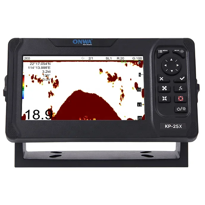
KP-25F (NEW!)
5-inch GPS Chart Plotter Fish Finder
Specifications
Plotter Characteristics
3 system waypoints: MOB,Start,cursor
10 proximity waypoints
plus MOB and Track Navigation or Goto Track modes
10 saved tracks (up to 16,000 track points each)
lets you retrace your path in both directions
Timer and AIS (CPA and TCPA) alarm
1000 Drawing Place Name; 8 colors for Drawing
Daylight exposed to sunlight
Night in dark environment
NOAA paperchart colors
GPS Receiver Characteristics
uses up to 50 satellites to compute and update your position
Hot start: 1 second
Velocity: 0.1 meter/sec without S/A
Velocity: 515 m/s
GPS Interface (NMEA0183)
AIS Interface (NMEA1083)
Echo Sounder Characteristics
Feet 15/30/60/120/200/400/600/1000/2000/3000
Fathoms 3/5/10/20/40/80/150/300/600
*The basic ranges can be changed on the system menu.
Zoom (200K and 50K zoom) and A-scope Display
| Display End Depth (m) |
5
|
10
|
20
|
40
|
80
|
150
|
200
|
300
|
600
|
1000
|
| Pulse-Length 200K(µs) |
120
|
220
|
320
|
520
|
920
|
1020
|
1020
|
1020
|
1020
|
1020
|
| Pulse-Length 50K(µs) |
170
|
270
|
370
|
570
|
970
|
1070
|
1070
|
1070
|
1070
|
1070
|
| TX Rate(pulse/min) |
2000
|
1333
|
706
|
353
|
171
|
98
|
75
|
53
|
38
|
27
|
| TX period(millisecond) |
30
|
45
|
85
|
170
|
350
|
610
|
800
|
1120
|
1580
|
2200
|
Temperature alarm (sensor required)
NMEA0183 Sentence Supported
GGA, GLL, GSA, GSV, RMC, HDG, HDM, HDT
VTG, ZDA, MTW, VWR, VWT, MWD, VPW, VHW
TLL, TTM, VDO, VDM, GNS, MTA
RMA, DBT, DPT, MWV, BWC, XTE, ZDL, WPL, AAM,
APB, BOD, RMB, DSC, MDA, RPM, XDR
GGA, GLL, RMC, GSA, GSV, AAM, APA
APB, BOD, BWC, BWR, DBT, DPT, HDT
MTW, RMB, TLL, VTG, WPL, XTE, ZDA
ZTG, ZDL, MWD, VPW, VWR, VWT
Power Supply
PHYSICAL
Antenna unit: IP66
Antenna unit: -25℃ to +70℃
Equipment List
Quick manual
GPS Patch Antenna with 4m cable (SMA connector)
Mounting Brackets
Standard accessories pack


Related products


Factory Price Survey Instruments High Precision South NTS-362R10U/N6 ToTal Station NoN-prism For Land Surveying With English


High Precision with IMU Function SMA26 Gnss Rtk Base And Rover Set For Land Surveying Instruments Gps Rtk receiver


Rangefinder 1500 Meters Binoculars 10×42 Waterproof Adult Birdwatching Binoculars


Foif RTS102R10 2″ Accuracy Total Station Measuring Surveying Instrument, 1000m Prism-free


Recently viewed items


SurvX Egstar South software GNSS RTK Measuring Software


